Windows
Mac
Windows
Log in / Sign up
Windows
›
Tags › digital mapping
Featured
Digital Mapping
Software
Relevance
Popularity
Rating
AutoCAD Raster Design
2,419
Autodesk Inc.
AutoCAD Raster Design is a comprehensive software program used to create, edit and analyze 3D projects...
Create, edit, and analyze 3D projects that include raster graphics. AutoCAD Raster Design works
gvSIG desktop
free
1,207
gvSIG Association
gvSIG desktop is a powerful software solution used by specialists to capture...
planning problems. It lacks
digital
image processing
XolidoSign
free
1,009
Xolido Systems, S.A.
XolidoSign is a Windows Application for electronically sign and/or timestamp...
3D files, videos,
maps
, music…...new technologies of
digital
signature and timestamping
Digifort Enterprise
free
744
Digifort - IP Surveillance System
Digifort Enterprise is a program for digital monitoring with unlimited support of simultaneous cameras...
a program for
digital
monitoring with unlimited support...by priority, synoptic
maps
, viewing
Wurli
232
Arturia
Wurlitzer-V in Wurli V is a physical model of the classic Wurlitzer 200A electric piano...
sound design. Extensive MIDI
mapping
of pedals, effects
PowerTracks Pro Audio
192
PG Music Inc.
PowerTracks Pro Audio is a multi-track music sequencing and digital...
music sequencing and
digital
audio recording program...automatic tempo
mapping
for MIDI performances
Qtpfsgui
free
156
Giuseppe Rota
Qtpfsgui is an open-source utility that can transform your plain digital photographs into professional...
transform your plain
digital
photographs into professional...to the Tone
Mapping
Panel
SmillaEnlarger
free
89
Mischa Lusteck
SmillaEnlarger is a small and free image enlarging tool that creates larger versions of your images without losing...
SmillaEnlarger is a small and free image enlarging tool that creates larger versions of your images
Able Software R2V
75
Able Software Corp.
R2V is an advanced raster to vector conversion software for automated map digitizing...
software for automated
map
digitizing
, GIS data capture...tracing from scanned
maps
and drawings. R2V
PixGPS
51
BR Software
With PixGPS it's easy to track the exact positioin where you took your photos...
see the location on a
map
or you can export...other software, such as
mapping
Lyceum
free
41
The Open University
Lyceum uses a Java client/server architecture to tackle a formidable set of networking requirements...
grab material from any
digital
source ...diagrammatic concept
maps
and textual documents
ATM Viewer
free
21
Snowflake Software
ATM Viewer allows you to visualize AIXM, IWXXM and Digital NOTAM files. Main features...
graphical layers. Support for
Digital
NOTAMs...own OGC Web
Map
Service
PictureRiver
16
Whimsoft
PictureRiver 1.7.2.0 is a screensaver for Windows computers. Unlike many other screensavers...
PictureRiver 1.7.2.0 is a screensaver for Windows computers. Unlike many other screensavers
Asset DB
free
14
NewField Information Technology
Asset DB is a free-to-use discovery and design toolset. The app provides a visual solution to map...
map
and manage document processing and workflow assets on a
digital
AutoCAD Raster Design 2013
13
Autodesk
Make the most of raster images, maps, aerial photos, satellite imagery...
maps
, aerial photos, satellite imagery, and
digital
...Electrical, AutoCAD®
Map
3D, AutoCAD® Mechanical
PHOTOMOD GeoMosaic
free
12
Racurs
PHOTOMOD GeoMosaic is intended for working with various types of digital images...
various types of
digital
images, including...as well as
digitized
raster
maps
. The program
ConceptDraw Solution Spatial Dashboard
free
9
CS Odessa
The Spatial Dashboard solution is the one that helps to visualize the spatial...
some organization performs,
digital
...benefits of using
digital
dashboards
SobekCM METS Editor
free
8
SobekCM
Windows form application creates METS-compliant metadata files for digital...
metadata files for
digital
library resources...to the structure
map
. Supports many bibliographic
Landformer Pro
free
6
Geomantics
GenesisIV's landscape definition tools have always been a strong feature of the system and we get many requests to make...
using topographic
maps
- Import data from graphics and
digital
WDI FX Pest Control
3
FileMaker, Inc.
What has only been a dream in the past is now a reality. WDI FX is the industry's first pest management...
WDO reports include
digital
graphs and photos...click - Works with Google
Maps
®, Skype® & SuperPages®
1
2
3
4
5
6
7
8
9
Tags
Software
Digital
Photos
Jpeg
Maps
Raster
Digital photography
Pro
Photo
Map
Featured stories
See all
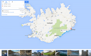
More Opportunities For Trips With Google Maps
Google Maps has recently released a new set of features that will definitely improve user traveling experience.
Mind Mapping Tools: Not To Lose Bright Ideas
Here goes a list of mind mapping tools that will surely help visual thinkers avoid half-concepts and patchy schemes while brainstorming.
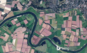
New Bing Maps Preview Focuses On Travelling Plans
Bing Maps Preview has just been updated with a few features that make planning your trips much more convenient.
Halo 5's map editor is now available for free in Windows 10
Unfortunately, Microsoft didn't give us any official information about when or if the game itself will be coming to Windows 10.
Draw on Windows Maps
The default Maps app that Windows offers gives you some very handy drawing options. Here's everything that you need to know about it.