Windows
Mac
Windows
Log in / Sign up
Windows
›
Tags › digital mapping
Featured
Digital Mapping
Software
Relevance
Popularity
Rating
Ham Radio Deluxe
7,068
Ham Radio Deluxe, LLC.
Ham Radio Deluxe provides a customizable interface to control your amateur transceiver using its built...
Ham Radio Deluxe provides a customizable interface to control your amateur transceiver using
Vextractor
819
VextraSoft
Vextractor can convert raster images to vector formats such as DXF, WMF, EMF, EPS, AI...
Vextractor can convert raster images (BMP, TIFF, PNG, JPG) to vector formats such as DXF, WMF
MICRODEM
free
469
Petmar Triilobite Breeding Ranch
MICRODEM is a freeware microcomputer mapping program written by Professor Peter Guth...
microcomputer
mapping
...
digital
elevation models - satellite imagery - scanned
maps
- vector
map
OCAD
426
OCAD AG
OCAD is a software program for drawing maps of all types (e.g. topographic maps, city maps, hiking and biking maps...
topographic
maps
, city
maps
, hiking and biking
maps
, Internet
maps
)...from
Digital
ObjectLand
417
Radom-T
GIS ObjectLand processes data organized as geoinformation database (GDB). Basic GDB components are maps...
with mouse or
digitizer
...continuous
map
; - copying, merging, and moving
maps
easyHDR BASIC
free
410
Bartłomiej Okonek
EasyHDR BASIC is an image processing software that produces and tone maps High Dynamic Range (HDR) images out of photo...
produces and tone
maps
High Dynamic Range...sequences taken with a
digital
camera. EasyHDR BASIC 2
TopoGun
365
SC PIXELMACHINE SRL
TopoGun is a stand-alone resurfacing, and maps baking application. The resurfacing functions in TopoGun will help...
alone resurfacing, and
maps
baking application...of your
digital
3D models. The
maps
baking
Eye4Software Hydromagic
238
Eye4Software B.V.
Hydrographic Survey Software for Windows, Load topographic or nautical maps, create singlebeam soundings...
can generate DTM's (
Digital
Terrain Models), depth...Google
Maps
or Bing
maps
as background
maps
. Since
TopoFusion
166
TopoFusion
TopoFusion is GPS Mapping software for Windows OS. It downloads maps (Topo...
from several public
map
servers...
map
display engine. PhotoFusion: Geo-reference
digital
PhotoSculpt Textures Demo
90
Hippolyte Mounier
Features: -simple to use with a nice and easy to learn interface -fast (1-2 min)...
Create photorealistic 3D models and hi-res seamless tileable 3D textures easily from two photos
GPS Tag Viewer
free
79
Andrew Stawowczyk Long, NLA
This program displays digital images and GPS Tags GPS Tag Viewer allows you to browse images...
This program displays
digital
images...GPS location in Google
Maps
(internet connection required)
Nevron .NET Vision
57
Nevron Software
Nevron .NET Vision helps you create enterprise grade digital dashboards, scorecards...
create enterprise grade
digital
dashboards, scorecards, diagrams,
maps
, MMI interfaces
Gorgeous Karnaugh Standard
47
Purefractalsolutions
Gorgeous Karnaugh Standard is a tool for students being trained in digital...
trained in
digital
electronics design...system, including initial K-
Maps
and minimization
GPS-Photo Link
44
GeoSpatial Experts
GPS-Photo Link is a program designed for mapping photographs. The program is able to map...
a program designed for
mapping
photographs. The program...camera or any
digital
camera
CLOX 2000
39
Mirage Audio Visual Media
A superb suite of analog and digital clocks and other timekeeping tools. Featuring timezone clocks...
Analog and
digital
clocks...include analogue and
digital
clocks, world
maps
for setting
DG Terrain Viewer
free
21
ET Spatial Techniques
It can be used just for viewing terrain meshes or to see your tracks and waypoints projected...
to view on 3D
digital
elevation
maps
mixed
onAround Immageo
free
7
Immageo
It is all about making your photos as memorable as when you took them...
patented method to match
digital
photos...Earth or Google
Map
. Immageo currently supports
ProJob
free
5
Prolec Ltd
ProJob is a free software utility supplied by Prolec for use with Digital Terrain Maps...
for use with
Digital
Terrain
Maps
(DTM)...utility for viewing
digital
terrain
maps
Territory Mapper
4
TTG
Territory Mapper is a mapping program designed specifically for territory design and realignment. The basic Territory Mapper...
a more basic set of 8
map
layers...design using the 5-
Digit
ZIP Code
map
layer which
PC-GIS
free
1
CMT Inc.
CMT PC-GIS is a lightweight GIS software solution for MS Windows. PC...
Basemaps: Displays
digitally
enhanced
maps
for background...Heads-Up
Digitizing
1
2
3
4
5
6
7
8
9
Tags
Maps
Mapping
Digital
Convert
Photo
Data
Map
GIS
Images
Conversion
Featured stories
See all
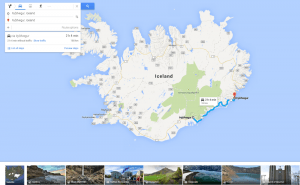
More Opportunities For Trips With Google Maps
Google Maps has recently released a new set of features that will definitely improve user traveling experience.
Mind Mapping Tools: Not To Lose Bright Ideas
Here goes a list of mind mapping tools that will surely help visual thinkers avoid half-concepts and patchy schemes while brainstorming.
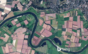
New Bing Maps Preview Focuses On Travelling Plans
Bing Maps Preview has just been updated with a few features that make planning your trips much more convenient.
Halo 5's map editor is now available for free in Windows 10
Unfortunately, Microsoft didn't give us any official information about when or if the game itself will be coming to Windows 10.
Draw on Windows Maps
The default Maps app that Windows offers gives you some very handy drawing options. Here's everything that you need to know about it.